Manufacturing
Explore Manufacturing
Latest about Manufacturing

TSMC could be inching closer to making 'all American' chips
By Anton Shilov published
TSMC may be accelerating its advanced packaging facility in Arizona to package the first processors as early as 2028, ahead of its partner Amkor.

TSMC claims 4.2X efficiency gain over a decade from N7 to A14 fabrication process
By Anton Shilov published
TSMC clarifies A14 specifications: Even more performance, but better tools might be needed to extract the full potential of the latest process technologies.

Nvidia’s $2B Synopsys stake strengthens its push into AI-accelerated chip design
By Luke James published
Premium Nvidia has taken a $2 billion equity stake in Synopsys, as the two companies announced a long-term collaboration to accelerate electronic design automation workloads on GPUs.

HPE adopts AMD’s Helios rack architecture for 2026 AI systems — new rack form factor gets its first major partner ahead of 2026 availability
By Luke James published
AMD and HPE are expanding their long-running partnership with a new agreement that will bring the AMD Helios rack-scale AI architecture into HPE’s product portfolio from 2026.

U.S government awards Gelsinger-backed EUV developer xLight with $150 million in federal incentives
By Anton Shilov published
U.S. government to inject up to $150 million in xLight, a startup developing EUV light source based on a particle accelerator, with the first CHIPS and Science Act grant by the Trump Administration.

Samsung touts 96% lower-power NAND design
By Luke James published
Samsung researchers have published a detailed account of an experimental NAND architecture that aims to cut one of the technology’s largest power drains by as much as 96%.

Industry's first TSMC COUPE-based optical connectivity solution for next-gen AI chips displayed — Alchip and Ayar Labs show future silicon photonics device
By Anton Shilov published
Alchip and Ayar Labs team up to build optical connectivity solution based on TSMC's COUPE framework that lets fabless chip designers to easily add optical connectivity to their designs.
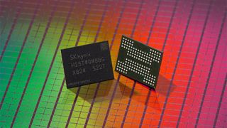
NAND wafer shortages push November contract prices up by over 60% — market tightens as hyperscalers purchase capacity for AI data centers
By Luke James published
TrendForce reported on December 1 that NAND Flash wafer supply tightened sharply in November as AI workloads and enterprise SSD orders continued to drive sustained demand.
Get Tom's Hardware's best news and in-depth reviews, straight to your inbox.
