Whoops! 20 Of The Funniest Fails From Apple's iOS Maps App
Berlin in Antarctica, a black hole in New York City, and problems with bridges. Apple Maps doesn't exactly convince us that is has the right alternative to Google. We show you examples of server-based issues, Flyover bugs, and incomplete satellite data.
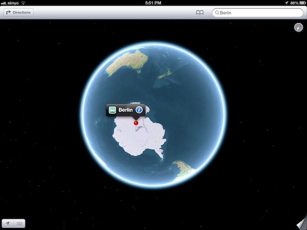
Antarctica, The Home Of Berlin
When people look for Berlin, they usually mean Germany's capital city. However, Apple Maps sends you to Antarctica instead. Admittedly, there’s a mountain called Berlin in Antarctica, but only Apple knows why that's the default in its mapping software.
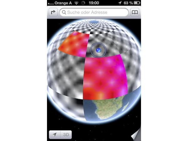
Earth: The Biggest Chessboard Ever
Apple Maps can take a while to load textures. Meanwhile, a generic picture is displayed for parts of the map that haven’t loaded yet. This can make three-quarters of the Earth look like a black and white chessboard.
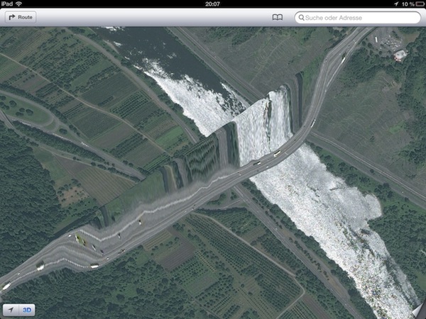
A Bridge Becomes A Mountain
This picture is a good example of the many problems Apple Maps has with displaying terrain in 3D. We're supposed to be looking at a bridge across a river. Apple Maps turns the bridge into a mountain. The technology Apple acquired from C3 Technologies seems to have an especially difficult time with structures spanning obstacles.
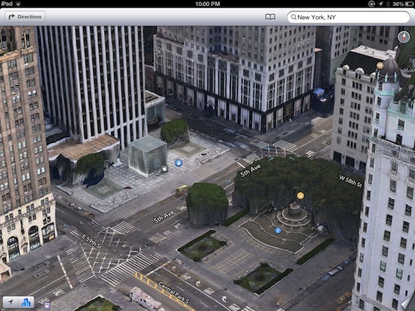
Lego Trees
Displaying landscape elements in 3D also seems to challenge Apple Maps. This is a view of the most famous Apple Store in the world, which is situated on an intersection in New York City. The store is correctly rendered as big glass cube. But it's probably safe to assume that the trees around the intersection aren't supposed to look like green Lego pieces.
A Dent In The Map
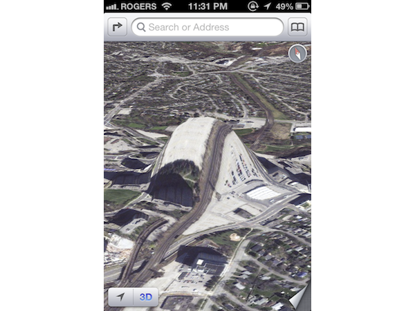
Sometimes it seems like the correct 3D representation of certain areas is more a matter of chance than anything else, particularly when you see a map that simply looks absurd for no discernible reason. This example shows the Islington Subway Station in Toronto. We’ll probably never know why it's a huge hill, instead.
A Gas Station For Your Flying Car
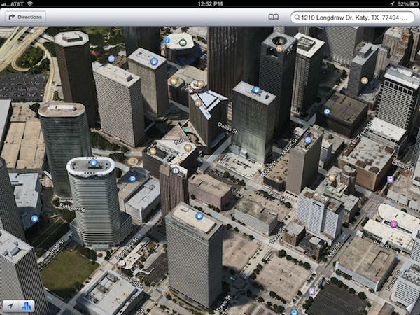
Apple thoughtfully marks points of interest like shopping centers, schools, restaurants, and gas stations with small symbols. In the middle of Houston, Texas, the company's servers seem to have mistaken rooftops for gas stations, which are handily located 40 stories off the ground for your flying car. Or maybe Apple just knows that everything's bigger in Texas?
The Golden Gate Bridge: Taking The Scenic Route
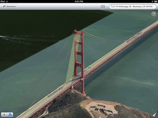
We’ve already seen that Apple Maps has trouble with streets going over bridges, and the Golden Gate Bridge in San Francisco, California, is another example of this. The road goes over the bridge as it should, but it does so by going all the way up to the top of the bridge’s suspension towers. At least the view should be spectacular from up there. The road then continues across the bridge after a small gap.
Get Tom's Hardware's best news and in-depth reviews, straight to your inbox.
Protection From Prying Eyes
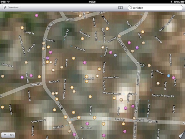
Sometimes Apple Maps just can't focus in when loading maps at all. This is the small town of Coniston in northern England. The street names are placed correctly, but otherwise all we get is a huge mess of pixels. So what’s going on in Coniston? We might never know.
A Black Hole In New York City
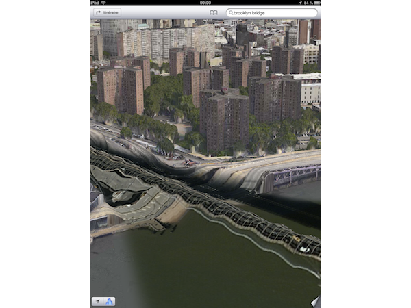
The Brooklyn Bridge in New York City didn’t escape the bugs with Apple's Flyover feature, either. It’s not that it isn’t displayed correctly; rather, it vanished altogether. All we get is a black line going through the river, cutting out a part of the map completely. You can work around this by reverting back to flat satellite images, of course, but we think this is more entertaining.
Are We There Yet?
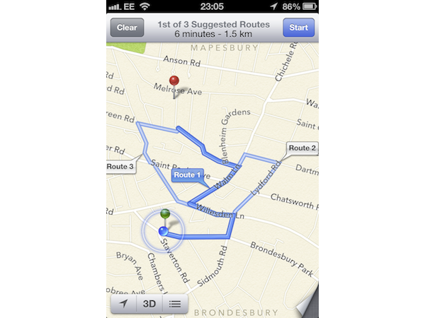
Google Maps sometimes has problems finding the most efficient route to your destination. But even if it takes you the long way, at least it gets you there. Apple Maps has you driving around the neighborhood in circles, and it doesn’t manage to get you all the way to where you want to go, which was only about a mile away in this case.
Close, But No...Apple
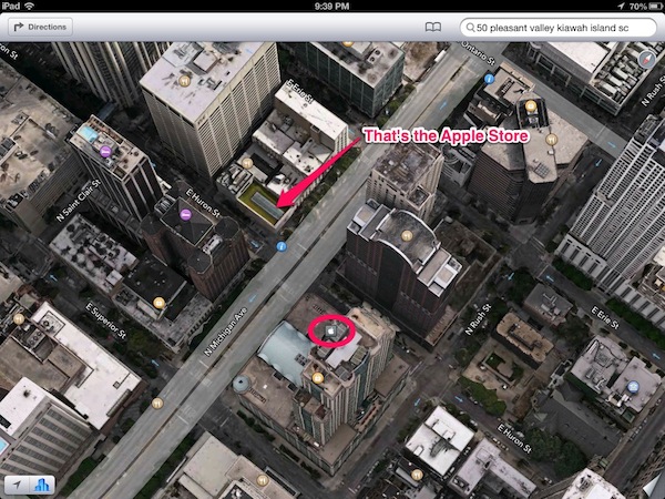
Sometimes, you might spontaneously feel the need to buy an Apple product. Apple Maps has you covered by displaying every last Apple Store there is. Then again, it looks like displaying them in the right places is beyond this application's scope. Here, Apple Maps confuses the address and ends up on a different street.
-
rdc85 It's funny to look at...........Reply
I'm wondering if they do any testing (alpha, beta, etc) or Q.C. of their apps at all? -
reprotected By fails, I was expecting more of a "turn right" into a river or a high-ground bridge, but most of these are immature satellite pictures and inaccurate location settings that were existent in the early Google Maps.Reply -
cookoy Apparently maps apps are more complex and harder to make right especially with 3D pics added. And apple just jump in thinking they could just fix any whoops on the fly and just ride out the storm.Reply
-
tobalaz I laughed pretty good.Reply
What Apple should do it keep this version and restamp it "Electronic Acid Trip Maps" for a novelty.
Oh, and add the purple flare to the pictures!
