Whoops! 20 Of The Funniest Fails From Apple's iOS Maps App
Berlin in Antarctica, a black hole in New York City, and problems with bridges. Apple Maps doesn't exactly convince us that is has the right alternative to Google. We show you examples of server-based issues, Flyover bugs, and incomplete satellite data.
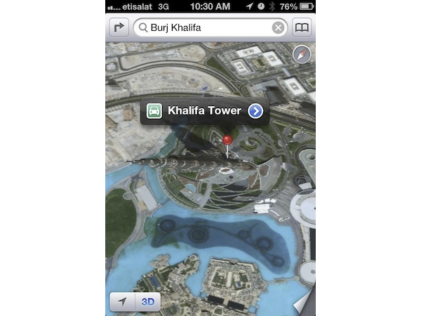
The Largest Shadow In The World
The Burj Khalifa, or Burj Dubai, is the tallest building in the world, and has been since 2008. Apple Maps' 3D display function should be a great way to see just how imposing of a structure it is. But the Burj Khalifa is flat in Apple Maps. Instead, we get our sense of the building's 828 m height from its shadow on the ground.
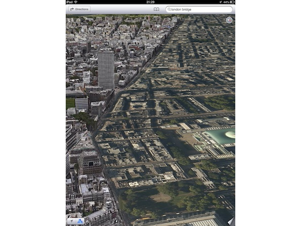
Why The Chicken Crossed The Road
Apple Maps' 3D display looks really nice, when it actually works. In this example from London, England, the difference between "working as intended" and "whoops" is as clear as two sides of the road. On one side, the buildings are flat, and on the other, they're rendered properly in 3D.
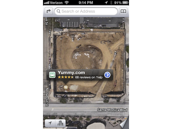
We Have A Bit Of A Wait Tonight
If you’re trying to find the closest restaurant, then maybe Apple Maps is not the way to go. In this example, the restaurant is in the middle of a construction site.
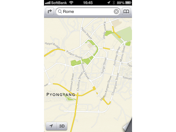
Rome In North Korea
Similar to Google Maps, Apple Maps lets you enter the name of a country, a city, or an address. Then, it shows you that location on a map. If you’re looking for Rome, Italy in Apple Maps, you’re presented with a much more adventurous suggestion: Pyongyang, North Korea’s capital city.
Row, Row, Row Your Boat
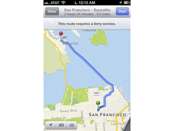
If you want to travel from San Francisco, California, to Sausalito, California, separated only by the San Francisco Bay, you’d expect to do so via the Golden Gate Bridge. Sausalito is just on the other side of it, after all. Apple knows the value of a good look at Alcatraz, though, and has you take a ferry across the bay instead.
Up And Down
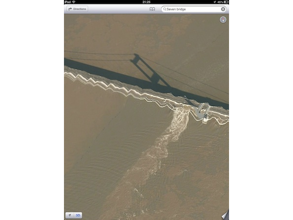
If you thought that we ran out of examples where Apple struggled with bridges in 3D, you were wrong. We present to you the Severn Bridge (or Apple Maps' version of it, anyway), connecting Monmouthshire in South East Wales and South Gloucestershire in South West England. We’re puzzled by the waves in the landmark, particularly when the bridge's shadow is displayed correctly.
A City In The Sky
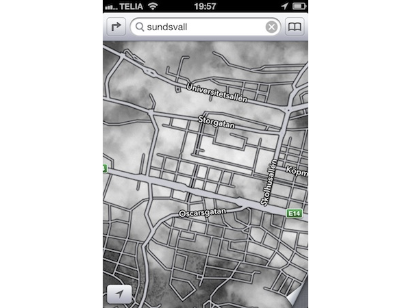
It looks like the city of Sundsvall, Sweden, has so much bad weather that Apple just couldn’t get a clear view of it from a satellite. No problem for Apple! The roads are just placed on top of the clouds. What lies underneath is up to your imagination.
Get Tom's Hardware's best news and in-depth reviews, straight to your inbox.
Film Noire
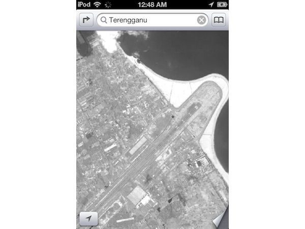
Are you a film noire fan? Then Apple Maps' view of the Malaysian state of Terengganu is for you. Not only is the state displayed with so little detail that it’s hard to make out, but it’s also in black and white. It looks like the image might have been taken 60 years ago. Apple Maps could use some updated pictures.
Just Not Getting There
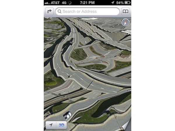
We already know that bridges aren't Apple Maps' strong suit, so what better way to beat a dead horse than show what happens when you try to have a look at multiple overpasses in the same shot? It looks like an earthquake had its way with this busy intersection of interchanges. It's hard to even make out the streets through the waves and edges.
-
rdc85 It's funny to look at...........Reply
I'm wondering if they do any testing (alpha, beta, etc) or Q.C. of their apps at all? -
reprotected By fails, I was expecting more of a "turn right" into a river or a high-ground bridge, but most of these are immature satellite pictures and inaccurate location settings that were existent in the early Google Maps.Reply -
cookoy Apparently maps apps are more complex and harder to make right especially with 3D pics added. And apple just jump in thinking they could just fix any whoops on the fly and just ride out the storm.Reply
-
tobalaz I laughed pretty good.Reply
What Apple should do it keep this version and restamp it "Electronic Acid Trip Maps" for a novelty.
Oh, and add the purple flare to the pictures!
